
L.01
Geospatial data science
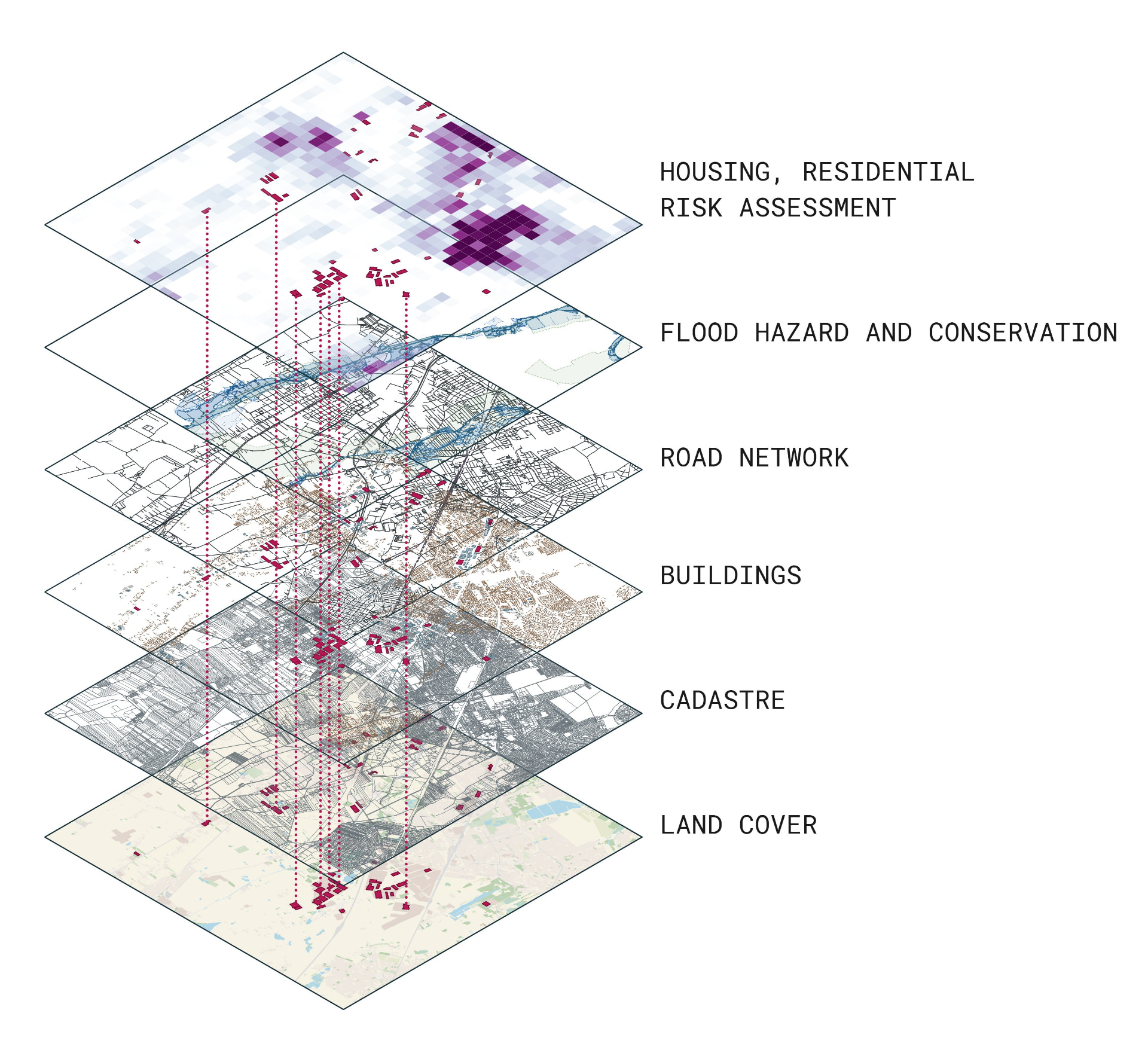
Spatial analysis, data modelling, and machine learning turn fragmented information into a legible picture of place.
GISMachine learningData analysis
BERI combines geospatial data science, decision-support systems for the industrial real estate market, and experience in industrial architectural design.
01 — Foundation
Each pillar is a distinct area of expertise. Together, they form a framework for assessing location, risk, and investment potential.
Spatial analysis, data modelling, and machine learning turn fragmented information into a legible picture of place.
Multi-criteria site assessment, stakeholder analysis, and permitting-risk studies support defensible investment decisions.
Design experience makes it possible to interpret data and constraints through the realities of an investment process.
02 — Knowledge
Instead of a portfolio, BERI publishes substantive studies explaining the methods, questions, and findings behind each pillar.
L.03
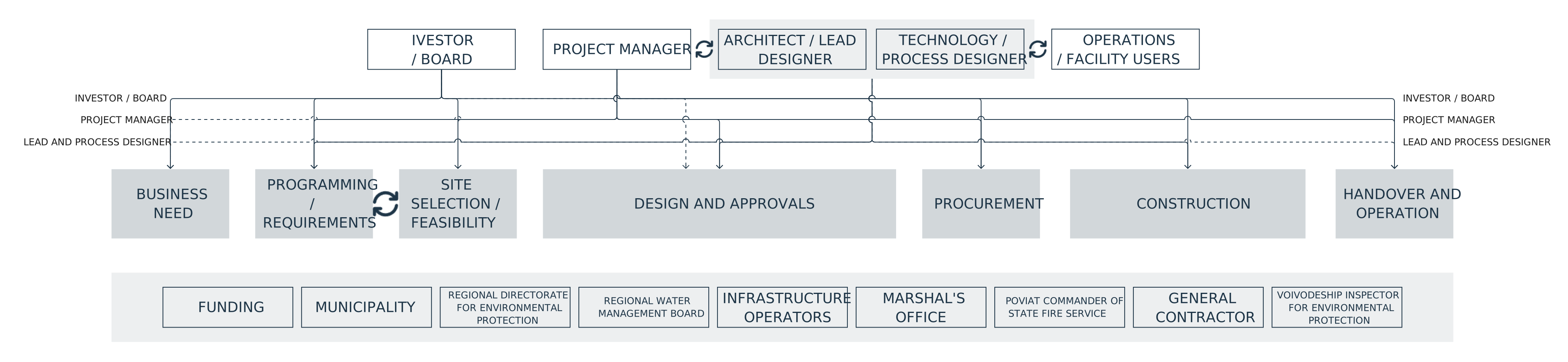
From a business need to an operating plant: the architect as the investor's adviser across the whole industrial investment.
L.01
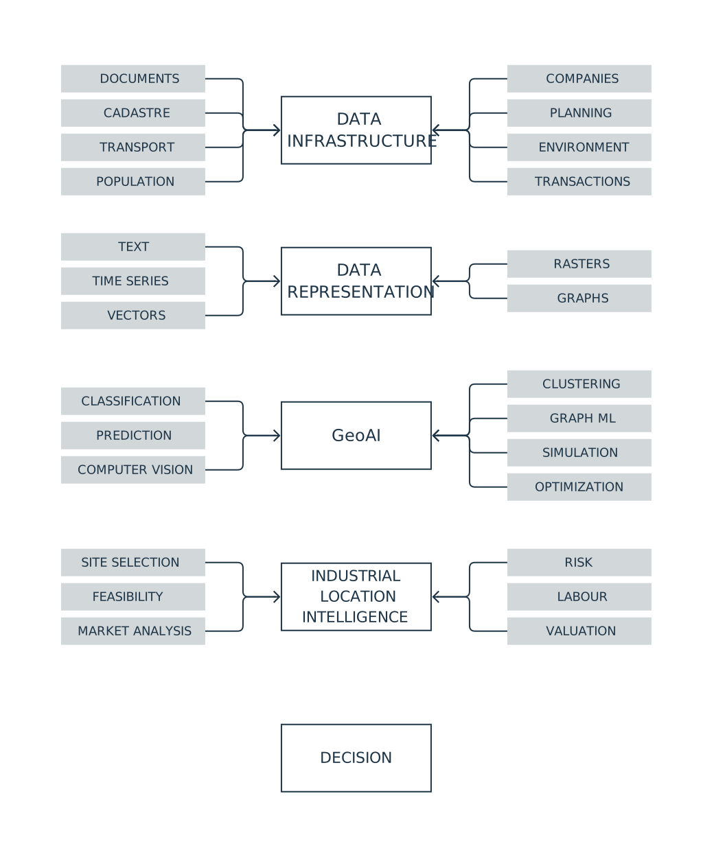
Using existing data resources for industrial location analysis
L.02
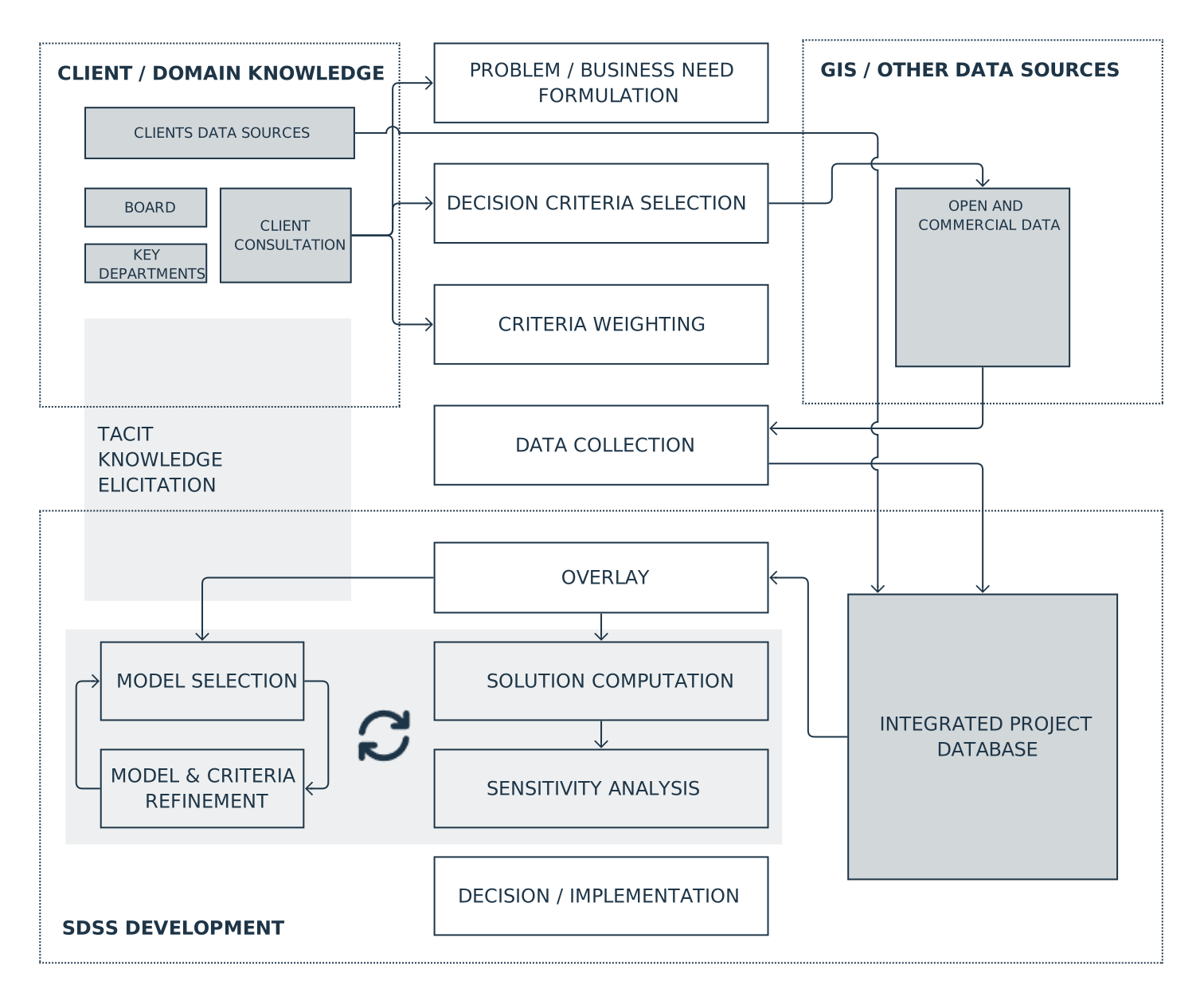
From data and criteria to a location recommendation: how a spatial decision support system for industry is built.
03 — About BERI
A decade of experience in preparing and designing industrial investments is now extended through geospatial data science and machine learning. BERI was established to help investors, designers, and professionals make better-documented decisions.
04 — Contact